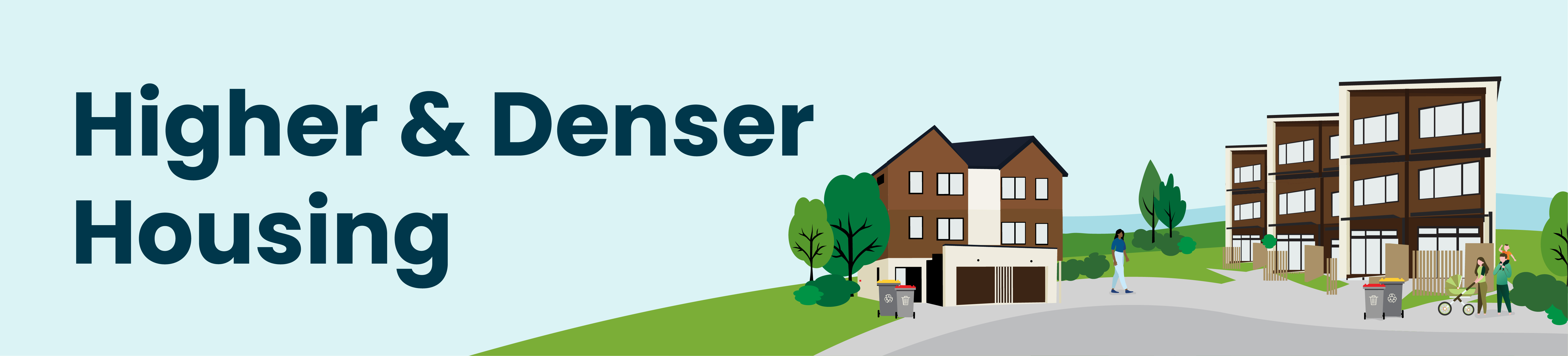
New Government rules for higher and denser housing have been incorporated into our District Plan.
About this plan change
The Government passed a law in late 2021 requiring councils to change their planning rules to allow housing up to three storeys high and three homes per section in most residential areas, without requiring council planning permission (resource consent). The legislation introduced ‘medium density residential standards’ that the Council must include in the District Plan (the City’s rulebook for subdivision and development).
In addition, the National Policy Statement on Urban Development (NPS-UD) means Council is also required to allow housing of at least six storeys within walking distance of our train stations, the CBD and the Petone commercial area. More housing (also known as intensification) may also be allowed in residential areas such as the suburban centres of Avalon, Eastbourne, Moera, Stokes Valley and Wainuiomata.
These changes legally needed to be incorporated into our District Plan as a Plan Change, which is separate from the current review of the entire District Plan.
Council may limit these new rules only in specific circumstances such as identified areas with natural hazards, heritage areas, or sites of significance to Māori. These specific circumstances are known as “qualifying matters”.
The plan change aimed to improve housing supply and affordability and means fewer restrictions on development. While the significant parts of the plan change are mandated by the legislation, there are some factors that the public were able to influence.
Some parts of Plan Change 56 took immediate legal effect from 18 August 2022 to 21 September 2023. Read the Summary of Immediate Legal Effect Information for the legal status of rules during that time.
Current status: On 30 August 2023, Councillors voted unanimously to accept the recommendations of an independent hearing panel that heard public submissions on Plan Change 56, which became operative on 21 September 2023. Read more here.
- Report of the Independent Hearing Panel
- Annotated version of plan change provisions
- Web viewer for recommended mapping changes - the maps as recommended were accepted by the Council without change and have now become operative. See the operative District Plan maps.
Documents associated with the plan change and hearing can be found below.
- Plan Change Document - Volume 1 (PDF 4.35 MB)
- Plan Change Document - Volume 2 (PDF 2.44 MB)
The zone maps, as modified by the Council's final decision on the plan, are now operative and have been incorporated into the operative District Plan maps. The maps as originally proposed have been archived - please contact the District Plan Team if you need historical superseded district plan maps.
- Wellington Regional Housing and Business Development Capacity Assessment 2019 (PDF 1.31MB)
- Wellington Regional Housing and Business Development Capacity Assessment - Housing update May 2022 (PDF 3.08MB)
- Lower Hutt Residential Character Assessment
- Hutt City Council Heritage Inventory Report - Sub-report (PDF 19.2MB)
- Additional Review of the Petone State Housing and Moera Railway Heritage Areas (PDF 19.2MB)
- Summary of natural hazard information (PDF 171KB)
- Hutt City Probabilistic Tsunami Hazard Maps (PDF 5.69MB)
- Lower Hutt District Plan Wind Rules (PDF 357KB)
- Review of Financial Contributions (PDF 435KB)
- Planning for the Future: A long-term vision for future housing growth and choice (PDF 5.93MB)
1) A new High Density Residential zone proposes:
- Buildings up to six storeys, subject to planning permission, within 1200m from the edge of the Lower Hutt CBD.
- Buildings up to six storeys, subject to planning permission, 800m from the Petone commercial centre and all train stations
- Buildings up to six storeys, subject to planning permission, in areas around Avalon and Moera commercial centres
- Buildings up to four storeys, subject to planning permission, in areas around the commercial shopping centres in Stokes Valley, Wainuiomata and Eastbourne.
2) New building heights and density are reduced in some areas of the city on sites with specific constraints to building. This means more development is still possible but consent from the Council will be required. Development will be constrained on sites:
- At risk from natural hazards like flooding, tsunami, and coastal hazards (including climate change and sea level rise) and within 20m of the Wellington fault line
- With heritage protection - the existing heritage protection in the District Plan will still apply. Six additional residential heritage areas have been identified and the changes propose to limit the scale of future development in these areas
- Of significance to Māori, including those close to marae and urupā, affected by the changes.
3) The government-mandated changes mean that the current low-density-zoned areas of Boulcott, Woburn and Lowry Bay will be included in the new intensification rules.
4) No maximum building height limit in the Lower Hutt CBD and the western part of the Petone commercial area, but most new buildings will continue to be assessed on a case-by case basis through the resource consent process.
5) Developers will be required to pay financial contributions for infrastructure and reserves, based on the number of dwellings created, not per subdivision.
6) Introduce minimum landscaping, outlook and façade glazing rules - these were optional government requirements but supported in our public feedback.
People have sent in submissions requesting modifications to the proposed plan change, and a summary of those requests and the full submissions are below.
People also had an opportunity to make a further submission, to state their support or opposition to decisions requested in submissions. A full set of further submissions are below.
Submissions closed on 24 November 2022 for giving feedback in support or opposition to the decisions requested.
- Public notice for Summary of Decisions Requested (PDF 32.1kb)
- Further Submission Form - RMA Form 6 (PDF 206kb)
- Summary of Decisions Requested - Volume 1 of 3 (PDF 1.07MB)
- Summary of Decisions Requested - Volume 2 of 3 (PDF 2.13MB)
- Summary of Decisions Requested - Volume 3 of 3 (PDF 2.19MB)
- Full Set of Submissions - Volume 1 of 3 (PDF 15MB)
- Full Set of Submissions - Volume 2 of 3 (PDF 16MB)
- Full Set of Submissions - Volume 3 of 3 (PDF 19MB)
- Full Set of Further Submissions (PDF 28MB)
A hearing for the proposed plan change was held from 12 to 28 April 2023.
Files associated with the hearing (including minutes from the hearing panel) will be added below as they become available.
Hearing schedule
The following schedule lists the submitters appearing at the hearing.
- Hearing schedule (PDF 205kb)
Hearing Panel minutes
As part of the hearing, the Hearing Panel has issued the following minutes:
Council Officer Report
The following report has been prepared by Council officers for the hearing:
- Council Officer Report (PDF 4.1MB)
- Council Officer Report Appendix 1 - Officer's recommended amendments (PDF 14.1MB)
- Council Officer Report Appendix 2 - Officer's recommended decisions on submissions (PDF 1.29MB)
- Council Officer Report Appendices 3- 10, includes legal advice and expert evidence (PDF 2.62MB)
Officer hearing presentation and verbal right of reply
- Opening presentation from reporting officers - 12 April
- Updated presentation from reporting officers - 18 April
- Reporting officers verbal right of reply - Speaking notes
- Reporting officers verbal right of reply - Supplementary information from Alistair Osborne
- Reporting officers verbal right of reply - Speaking notes of Chessa Stevens
Officer final written right of reply - 9 June
- Reporting Officers’ Written Response to Hearing
- Web viewer with recommended amendments to the maps
- Appendix 1 - recommended amendments to the plan change
- Appendix 2 - further legal advice of DLA Piper
- Appendix 3 - further heritage evidence of Chessa Stevens
- Appendix 4 - further flood hazard evidence of Alistair Osborne
- Appendix 5 - further coastal inundation evidence of Scott Stephens
- Appendix 6 - number of properties in updated natural hazard overlays
- Appendix 7 - building consent figures
- Appendix 8 - memorandum on resilience aspects of Tupua Horo Nuku
- Attachment 9 - encroachment licences - guide to completing an application
- Attachment 10 - notice of appeal - Kāpiti District Council v Waikanae Land Company
- Attachment 11 - Tupua Horo Nuku landscape and urban design plan
Other documents from Council officers
The following other documents have been prepared by Council officers for the hearing:
- Legal advice from DLA Piper on approach to appropriate restrictions on MDRS (PDF 160kb)
- Word documents of District Plan chapters, incorporating recommended amendments from the Council Officer Report (Zip 34.4MB)
- Online map viewer showing PC56 maps with walkable catchment areas
- Diagram of additional information requirements for qualifying matters
The following Statements of Evidence have been filed by submitters:
Department of Corrections
- Statement of Evidence of Maurice Dale (PDF 268kb)
- Supplementary statement of evidence of Maurice Dale
Greater Wellington Regional Council
- Statements of Evidence for Wellington Regional Council - multiple authors (PDF 3.2MB)
- Summary statement of Richard Sheild
- Summary statement of Barry Lowe
- Supplementary evidence of Barry Lowe
- Waiwhetū Aquifer - Source Water Risk Implications 2023
- Summary statement of Iain Dawe
- Supplementary evidence of Iain Dawe
- Speaking notes of Pamela Guest
- Talking points of Stu Farrant
- Diagram of Stu Farrant
- Consolidated version of relief sought by Greater Wellington Regional Council
Heritage New Zealand Pouhere Taonga
- Statement of Evidence of Reuben Daubé (PDF 9.6MB)
- Statement of Evidence of Dean Raymond (PDF 540kb)
Kāinga Ora
- Statement of Evidence of Dave Pearson (PDF 1.1 MB)
- Statement of Evidence of Nicholas Rae (PDF 945kb)
- Attachments to Statement of Evidence of Nicholas Rae (PDF 11.9MB)
- Diagrams tabled at hearing by Nicholas Rae
- Statement of Evidence from Gurv Singh (PDF 339kb)
- Statement of Evidence of Karen Williams (PDF 1.5MB)
KiwiRail
- Statement of Evidence of Mike Brown (PDF 260kb)
- Statement of Evidence of Stephen Chiles (PDF 223kb)
- Statement of Evidence of Cath Heppelthwaite (PDF 286kb)
- Memorandum of Counsel for KiwiRail - Further information
- Appendix A - Christchurch Independent Hearings Panel - Decision 57
- Appendix A - Christchurch Independent Hearings Panel - Decision 17
- Appendix A - Christchurch Independent Hearings Panel - Decision 10
- Appendix A - Marlborough - Consent Order
- Appendix A - Whangarei - Consent Order - Noise and Vibration
- Appendix A - Whangarei - Consent Order - Setback
- Appendix B - Supplementary evidence of Cath Heppelthwaite
- Appendix C - GIS vibration overlay
Petone Historical Society
- Statement of Evidence of Sylvia Allan (PDF 667kb)
- Additional information from Sylvia Allan - Changes sought by Petone Historical Society
Retirement Villages Association and Ryman Healthcare Ltd
- Statement of Evidence of Gregory Akehurst (PDF 230kb)
- Statement of Evidence of Ngaire Kerse (PDF 669kb)
- Statement of Evidence of Phil Mitchell (PDF 391kb)
- Supplementary evidence of Phil Mitchell
- Supplementary evidence of Gregory Akehurst (PDF 1.3MB)
RLW Holdings Ltd
Stride Investment Management Ltd, Investore Property Ltd, Oyster Management Ltd, Argosy Property No 1 Ltd
- Statement of Evidence of Joe Jeffries (PDF 343kb)
- Speaking notes of Joe Jeffries
- Recommended amendments from submissions of Stride, Investore, Oyster and Argosy
- Section 32AA Evaluation of amendments sought in submission of Stride, Investore, Oyster and Argosy
Voluntary Heritage Group
- Statement of Evidence of Neil Kemp (PDF 1.7MB)
Submitters have filed the following legal submissions:
- Department of Corrections - Legal submission
- Department of Corrections - Summary of legal submission
- Greater Wellington Regional Council - Legal submission
- Greater Wellington Regional Council - Summary of legal submission
- Greater Wellington Regional Council - Supplementary legal submission
- Kāinga Ora - Legal submission
- Kāinga Ora - Supplementary submissions
- KiwiRail - Legal submission
- Retirement Village Association and Ryman Healthcare Ltd - Legal submission
- Retirement Village Association and Ryman Healthcare Ltd - Supplementary legal submissions
- Stride Investment Management Ltd, Investore Property Ltd, Oyster Management Ltd and Argosy Property No 1 Ltd - Legal submission
- Voluntary Heritage Group - Legal submission
The following other statements and documents have been provided by submitters as part of the hearing:
- Alan Smith - Statement
- Andrew Edgar - Statement
- Anne Smith - Statement with summary of recommendations
- Anne Smith - Presentation
- Ashley Roper - Statement
- Central Apartments Ltd - Presentation from Leo Archer
- Chris MacKay - Article from Vibrant Hutt titled 'MacKay on money (and other things)'
- Cuttriss Consultants Ltd - Supplementary information
- Cuttriss Consultants ltd - Recommended amendments
- David Smith - Speaking notes
- Fiona Christeller - Statement
- Fiona Christeller - Additional information
- Ian McLauchlan - Presentation
- Jackson Street Programme - Notes from John Donnelly
- Laura Skilton - Statement
- Living Streets Aotearoa - Presentation
- Merran Bakker - Statement
- Mary and Michael Taylor - Speaking notes
- Ministry of Education - Statement tabled at hearing (PDF 157kb)
- Nick Ursin - Statement
- Peter Kirker - Statement
- Peter Ricketts - Statement
- Rebecca Leask and Mike Stewart - Presentation
- Retirement Villages Association - Statement of Maggie Owens (PDF 265kb)
- Retirement Villages Association - Summary statement of Maggie Owens
- Ryman Healthcare Ltd - Statement of Matthew Brown (PDF 242kb)
- Ryman Healthcare Ltd - Summary statement of Matthew Brown
- Sandra Walker - Statement
- Shayne Hodge - Statement
- Steve Winyard - Statement
- Steven Beech - Statement tabled at hearing
- Sylvia and Bill Allan - Speaking notes
- Te Rūnanga o Toa Rangatira - Statement of Onur Oktem
- The Tuatoru and Sienna Trusts - Statement of Brian Boyer
- Tom Macleod - Photos
- Tony Smith - Speaking notes
- Tony Smith - Article titled 'The role of climate change in extreme rainfall associated with Cyclone Gabrielle over Aotearoa New Zealand's East Coast'
- Transition Town Lower Hutt - Presentation
- Transition Town Lower Hutt - Speaking notes
- Transition Town Lower Hutt - Poster
- Transpower New Zealand Ltd - Statement tabled at hearing (PDF 297kb)
- Voluntary Heritage Group - Presentation
- Voluntary Heritage Group - Supplementary slides
- Voluntary Heritage Group - Article titled 'The price premium of heritage in the housing market'
- Wayne Donnelly - Statement
- York Bay Residents' Association - Speaking notes of Susan Ewart
- York Bay Residents' Association - Email from Susan Ewart
The independent hearing panel released the bulk of its report to Council on 23 August 2023. Two reference appendices are still to come but do not affect the panel's reasoning or recommendations.
- Recommendations of the Independent Hearing Panel - Report
- Recommendations of the Independent Hearing Panel - Appendix 1 - Panel recommendations on relief sought by submissions and further submissions - still to come
- Recommendations of the Independent Hearing Panel - Appendix 2 - Annotated version of plan change provisions
- Recommendations of the Independent Hearing Panel - Appendix 3 - Clean copy of affected district plan chapters - still to come
- Recommendations of the Independent Hearing Panel - Appendix 4 - Recommended mapping changes
- Web viewer for recommended mapping changes
The panel's report is highly detailed. Council staff have summarised the panel's key recommendations, compared to the plan change as proposed:
- Reductions in the spatial area of the High Density and Medium Density Residential Activity Areas in parts of Harbour View, Korokoro, Manor Park, Normandale, and Tirohanga,
- Increases in the spatial area of the High Density Residential Activity Area in parts of Moera and Naenae,
- A shift in the approach to Eastbourne, Stokes Valley, and Wainuiomata, to downzone from High Density Residential to Medium Density Residential but simultaneously applying a higher height limit of 18 metres and over a wider area,
- An increase in the height limit to 36 metres (approximately ten storeys) immediately adjacent to the city centre,
- Not proceeding with the proposed new residential heritage areas of Hardham Crescent, Hutt Road Railway, Moera Railway, Petone Foreshore, Petone State Flats, and Wainuiomata Terracrete Homes,
- A slight expansion of the Jackson Street Heritage Area,
- More restrictions on building scale near Korokoro urupā,
- A reduced role for the out-of-plan Medium Density Design Guide,
- A selectively more generous recession plane in the High Density Residential Activity Area for developments that provide a significant number of new homes, to encourage buildings to be located closer to the street,
- A new resource consent pathway to provide for small-scale commercial activities in High Density Residential areas at the ground floor of apartment buildings,
- Significant rewording of objectives, policies, and matters of discretion around urban design issues,
- Being less enabling of development in the High Coastal Hazard Overlay, including reducing the number of residential units permitted as of right from two per site to one per site, and
- Various other corrections, clarifications, and small tweaks.
What do I need to know?
The Medium Density Residential Standards are a set of rules that Council must include in the District Plan. These include rules (known as “standards”) on:
- The number of residential dwellings per site
- Building height
- Building height in relation to boundary (also known as a recession plane)
- The distance between buildings and the property boundaries
- The amount of the site that can be built on
- Outdoor living space
- Outlook space (essentially space outside windows – not utility room windows)
- Windows on street facing façades of buildings
- The area of the site required to be landscaped
If a proposed building met these rules, the building would be allowed (planning permission/resource consent not required). However, if a proposed building would not meet one or more of these rules, the building would need Council planning permission (resource consent). Building consent will still be required for any new dwelling.
See details of the Government’s Medium Density Residential Standards, with examples of the types of developments and buildings that could be built without Council planning permission.
The Government’s Medium Density Residential Standards also include objectives and policies that must be included in the District Plan, as well as requirements for subdivisions and notification of resource consent applications. See the full list of the Medium Density Residential Standards.
More information on how Hutt City Council proposes to incorporate the Medium Density Residential Standards (rules) into its district plan will be made available when the Intensification Planning Instrument is notified on 18 August 2022.
The Intensification Planning Instrument includes two residential zones:
- High Density Residential Activity Area
- Medium Density Residential Activity Area.
View the proposed locations for these zones
These zones would replace the District Plan’s existing zones:
- General Residential Activity Area
- Medium Density Residential Activity Area
- Special Residential Activity Area
- Historic Residential Activity Area.
The High Density Residential Activity Area zone would apply to residential areas within 1200 metres of the city centre, 800 metres of the Petone commercial area and 800 metres of train stations, as well as areas adjacent to the suburban commercial centres of Avalon and Moera suburban centres. Six-storey buildings would be allowed in this zone, with Council planning permission (resource consent). However, the Medium Density Residential Standards/rules (not the building height standard) would also apply. This includes rules on the amount of building near property boundaries and the number of dwellings per site and would require outdoor living space and landscaping. If the rules are not met, Council planning permission (resource consent) would be required.
The Medium Density Residential Activity Area zone would be all other areas that are currently in the General Residential Activity Area zone and Medium Density Residential Activity Area zone. These are predominantly in the Eastern Bays, Stokes Valley and Wainuiomata, but also include some areas on the valley floor. All Medium Density Residential Standards/rules would apply in this area, including 11 metres maximum building height (3 storeys). If the rules are followed, then no Council planning permission (resource consent) would be necessary.
For the most part, areas that are currently within the Hill Residential Activity Area zone and the Landscape Protection Activity Area zone won’t be affected by proposed changes to the district plan. The only exception is for areas in Western Hill suburbs that are in a walkable distance of the city centre or train stations (1200 metres and 800 metres, respectively). This includes some areas in Korokoro, Maungaraki, Normandale, Harbour View and Tirohanga.
More information on what the proposed changes will mean for the residential areas of Lower Hutt will be made available when the proposed plan change (IPI) is notified on 18 August 2022.
The proposed change keeps three for the existing commercial zones:
- Central Commercial
- Petone Commercial
- Suburban Mixed Use
The other two zones, Special Commercial and Suburban Commercial, will be deleted and the sites rezoned to Suburban Mixed Use.
The Central Commercial zone would cover the same area as it does now, although the precincts have been removed. All new buildings (except very small ones) will still need Council planning permission (resource consent) and would be assessed against the Central Commercial Design Guide. The main change in this area is that there is no longer a maximum building height limit, and the height of buildings will be assessed on a case-by-case basis in the resource consent process (Council’s planning permission).
The Petone Commercial zone would continue to cover the same area. In Petone Commercial 1 along Jackson Street, heritage controls would continue to apply to most of the area. All new buildings and the demolition of existing buildings would require Council planning permission (resource consent) to protect heritage buildings and make sure the design of new buildings is compatible with the area. Buildings are limited to 2-3 storeys. Outside this area, buildings up to 6 storeys are possible, but Council planning permission (resource consent) would be required for all new buildings.
In the western end of the Petone Commercial area, Petone Commercial 2, there would be no building height limit, but most new buildings would be assessed case-by-case in the Council planning permission process (resource consent), including against the Petone Commercial Design Guide. The existing recession plane and building height rules would stay on sites around Te Puni Urupā to protect its significant cultural value.
The Suburban Mixed Use zone would continue to apply to the centres covered in the current district plan but would be expanded to the former Suburban Commercial and Special Commercial zones. The only change to this zone is building height limits. In most cases building height limits will be consistent with the building height limits in surrounding residential zones, however building height limits of 22m (6 storeys) will apply in the following circumstances:
- Centres within 1200m walking distance of the city centre, 800m walking distance of Petone commercial areas, and 800m walking distance of railway stations
- Around the commercial centres of the suburbs of Wainuiomata, Stokes Valley, Eastbourne, Moera, and Avalon
In the rest of the city, commercial areas will allow buildings of 12m (3 storeys).
While Council is required to change its district plan to enable greater intensification, in some circumstances Council is still able to limit building heights and housing density. These circumstances, known as “qualifying matters”, in the Resource Management Act and National Policy Statement on Urban Development.
Qualifying matters include:
- Areas at significant risk from natural hazards
- Historic heritage areas
- Sites of significance to Māori.
Whilst the Government wants more housing overall, it has made it clear that there are limits to this. We can’t increase the amount of housing in areas where there are high risks of natural hazards (like near to streams), nor can we build over an area of significance to Māori, or a heritage area. Therefore, the district plan will not allow as much housing density and building height in these areas, but some building is still acceptable.
The qualifying matters that have been identified for Lower Hutt are:
- Areas at significant risk from natural hazards
- Heritage areas
- Sits of significance to Māori
- Nationally significant infrastructure
- Public open space
More information on qualifying matters, including the qualifying matters that have been identified for Lower Hutt, will be available in August for public feedback.
Council can limit the new building height and density requirements in some circumstances. This includes for the protection of heritage. This protection means greater development is still possible, but resource consent will be required.
To limit intensification via the qualifying matter provisions of the legislation, Council is required to have a strong evidence base. An evaluation of Lower Hutt’s historic heritage was recently completed by external heritage experts and the findings have been fed into this plan change.
The district plan change would introduce six new heritage precincts, with restrictions around building heights and density in these precincts. This aims to recognise and protect the heritage values associated with these areas. The table below summarises each of the areas and what the rules mean for future development within these areas.
In addition, the extent of three historic heritage areas that are currently identified in the District Plan would be amended in some cases. However, the existing policies and rules for these areas would still apply after this plan change. This is also the case for individually listed heritage buildings or structures.
The information on this page is also available in a print/download format.
| Precinct | Is this a new area or existing? | Summary of proposed rules |
|---|---|---|
| Residential Heritage Precinct | Six separate areas in Petone, Moera and Wainuiomata. These are new areas. |
|
| Jackson Street Heritage Precinct | Applies to areas of Jackson Street generally between Cuba Street and Victoria Street. This area has been identified in the District Plan as a heritage area since the District Plan first became operative in 2003. |
|
| Riddlers Crescent Heritage Precinct | Riddlers Crescent has been identified in the District Plan as a heritage area since the District Plan first became operative in 2003. The area is currently identified through the Historic Residential Activity Area. |
|
| Heretaunga Settlement Heritage Precinct (Patrick Street) | The Patrick Street area has been identified in the District Plan as a heritage area since the District Plan first became operative in 2003. The area is currently identified through the Historic Residential Activity Area. However, twelve properties in the area are also identified in a separate heritage area in Chapter 14F: Heritage Buildings and Structures. |
|
Council can control building heights and housing density in some circumstances to protect housing from significant risks from natural hazards. This protection means greater development is still possible, but resource consent may be required.
New information means that the Council has been able to clearly identify areas at risk from natural hazards. Natural hazards is a “qualifying matter" in the proposed district plan change. This means that Council has chosen to control development to help to protect buildings from the risk of natural hazards.
These limitations on height and density for new housing and commercial or retail activities in areas of natural hazard risk apply only to areas covered by the new intensification requirements. This means that the proposed natural hazard rules apply to the following zones:
- Medium Density Residential Activity Area
- High Density Residential Activity Area
- Suburban Mixed Use
- Petone Commercial
- Central Commercial
The full review of the District Plan will address natural hazard risks more comprehensively across Lower Hutt, and this is expected in late 2023/early 2024 and will include further opportunities for the community to have their say.
| Natural Hazard Layer | What does this layer show? | What does it mean if my property is in this area? |
|---|---|---|
| Flood Hazard: Stream Corridor (New) | The modelled extent of stream flow during a 1-in-100-year storm event (including sea level rise and increased rainfall) |
|
| Flood Hazard: Overland Flow Path (New) | The modelled flow path of flood water (not streams) during a 1-in-100-year storm event (including sea level rise and increased rainfall) |
|
| Flood Hazard: Inundation Area (New) | The modelled area where flooding from a 1-in-100-year storm event is expected to occur (including sea level rise and increased rainfall) |
|
| Tsunami: High Coastal Hazard (New) | The modelled extent of a 1-in-100-year tsunami event (including sea level rise) |
|
| Tsunami: Medium Coastal Hazard (New) | The modelled extent of a 1-in-500-year tsunami event (including sea level rise) |
|
| Tsunami: Low Coastal Hazard (New) | The modelled extent of a 1-in1000-year tsunami event (including sea level rise) |
|
| Coastal Inundation: High Coastal Hazard (New) | The modelled extent of coastal flooding from a 1-in-100-year storm event |
|
| Coastal Inundation: Medium Coastal Hazard (New) | The modelled extent of coastal flooding from a 1-in-100-year storm event (including sea level rise and vertical land movement) |
|
| Wellington Fault Hazard (area updated) | The mapped area where the Wellington Fault is located. |
|
The District Plan approach to three-water infrastructure (freshwater, wastewater, and stormwater infrastructure) would be largely unchanged.
The key components of this approach are as follows:
- For the residential areas that are affected by the proposed plan change, developments of four or more dwellings would require Council permission, including considering if there is infrastructure to service the proposed buildings (this is currently the case for development of three or more units).
- Developers contribute to infrastructure costs:
- For planned infrastructure, developers pay Development Contributions, the details are in the Long Term Plan
- For unplanned infrastructure necessary for a new development, Financial Contributions, details are in the District Plan
- To reduce the impacts of heavy rainfall on stormwater infrastructure, rules require new buildings in relevant residential zones to have stormwater retention tanks and a proportion of the site must be permeable surface area. If these standards are not met, Council planning permission (resource consent) is required, and the impacts of the development on stormwater infrastructure must be assessed through the resource consent process.
Timeline
| Date | Stage | Related Documents |
|---|---|---|
| April 2022 | Initial feedback sought from the community. | See the survey results |
| May 2022 | Council works with Mana Whenua partners for their advice on the draft proposal and incorporates public feedback | |
| 18 August 2022 | Proposed Plan Change released for public submissions until 20 September | Public notice Read the proposed plan change - volume 1 Read the proposed plan change - volume 2 |
| 10-24 November 2022 | Publicly notify the summary of submissions and invite further submissions either supporting or opposing submissions from the initial round. | See "Summary of Decisions Requested" higher up on this webpage. |
| 12-28 April 2023 | Public hearings for submissions in front of an independent panel followed by recommendations to Council of any further changes that should be made. | See "Hearing Details and Council Officer Report" higher up on this webpage. |
| 23 August 2023 | Independent Hearing Panel issued recommendations | See "Report of the Independent Hearing Panel" higher up on this webpage. |
| 30 August 2023 | Council considered report of the Independent Hearing Panel and voted to accept all recommendations | |
| 21 September 2023 | Council publicly notified decision and the Plan Change became operative. The Resource Management Act does not provide for appeals within this streamlined process. |