We’ve made small-scale improvements around the entrance to the Hutt River Trail next to Waione Bridge.
About Hīkoikoi Landing
Hīkoikoi Landing is located next to Waione Street and Te Awa Kairangi Hutt River. This is an area of importance for Mana Whenua and forms part of the ‘Eastern Gateway’ in the Petone 2040 Spatial Plan.
From our stakeholder and community engagement we know that people are keen on:
- Revealing the cultural importance and history of the area.
- Improving the health of Te Mome Stream and surrounding environment.
- Preventing illegal dumping.
- A better and more visible entrance to the Hutt River Trail.
- Safer and more accessible ways to move around.
- Improved signage and wayfinding.
Following this engagement, we developed the small-scale improvements for the area:
- A path connecting to the Hutt River Trail.
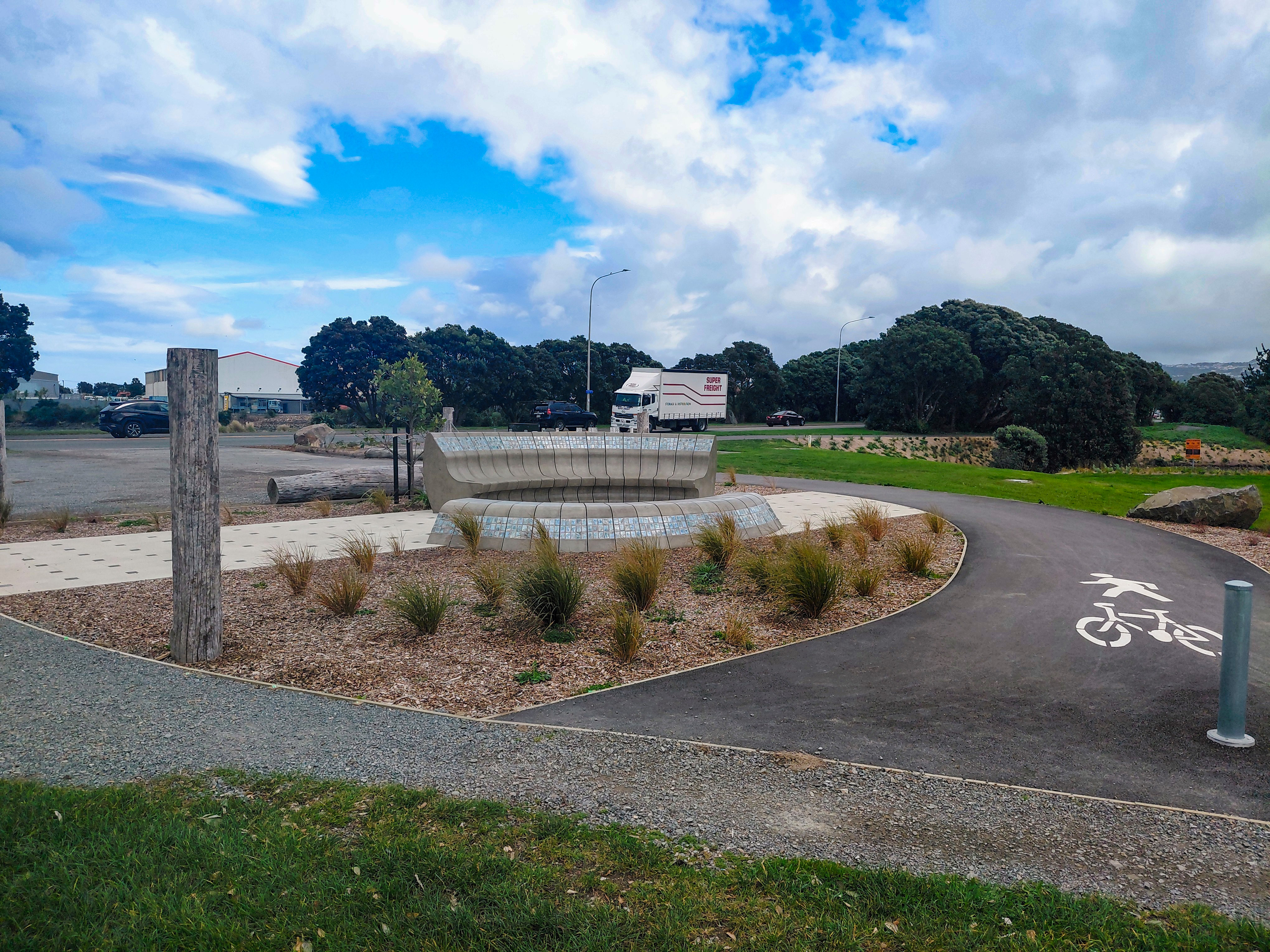
- A hākari inspired rest area and cultural markers to highlight the cultural value of the area.
- Riparian planting to improve the health of Te Mome stream.

Whakapapa (History) of the Area
At the mouth of Te Awa Kairangi, where the river meets sea, generations of Mana Whenua built their lives around the abundance of the estuary. Pā and kāinga flourished here. Hīkoikoi Pā on the western shore, Waiwhetū Pā on the east, and Paetutu Kainga further upstream, sustained by a rich mahinga kai (food gathering place) and connected to trade and travel routes via the river. Here, kahawai were once so plentiful it was said you could have walked across the river on their backs.
To explore the full history behind this area, see Pito One East.
Makaurangi – Place identity
Makaurangi is about designing places that reflect the history of the area, helping people connect to our shared heritage.
We have been working with Mana Whenua to design this project.
Elements of the landing speak to Mana Whenua history and the relationship they hold with this area.
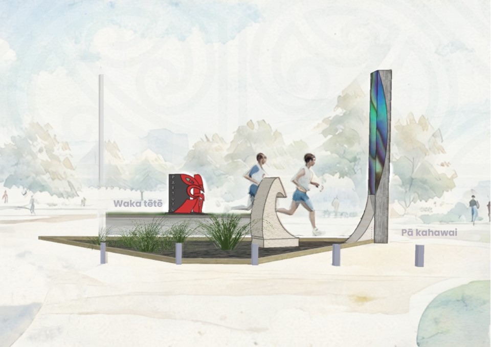
Pā Kahawai
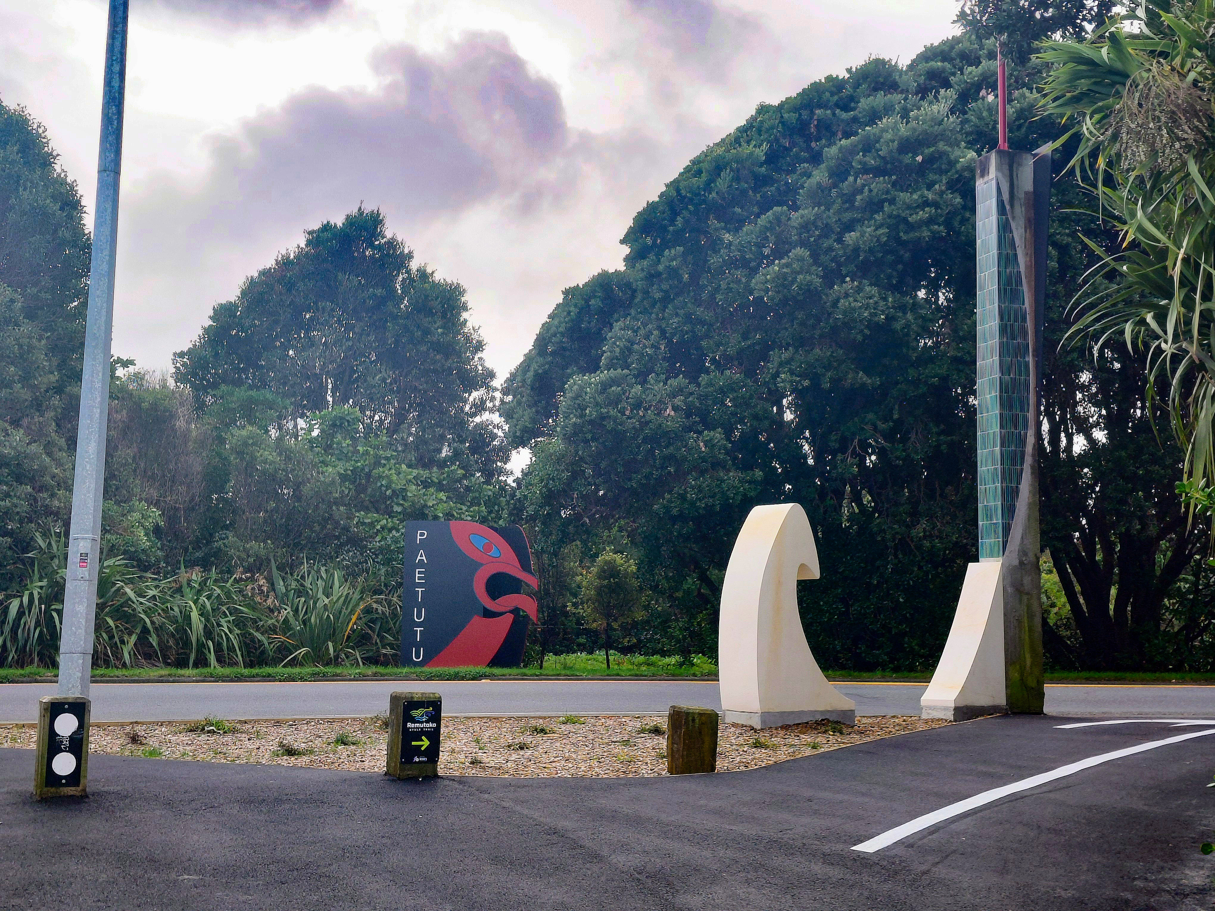
Located on the western end of Waione Bridge, the Pā Kahawai cultural marker honours the rich history of kai moana (seafood) collection in the area. Pā kahawai are traditional Māori lures used specifically for catching kahawai, often inlaid with pāua shell to attract fish, similar to modern fly-fishing lures.
Today, fishermen continue the tradition, casting their lines from the Waione Bridge in pursuit of kahawai.
Waka Tētē
The Waka Tētē cultural marker highlights the significance of waka in Mana Whenua heritage.
The waka tētē was specifically designed for transporting goods across waterways, playing a crucial role in Mana Whenua occupation across Te Whanganui a Tara. These vessels were used to carry kai moana such as kōura (crayfish) and pāua (abalone) from bays along the southern coast.
What makes these vessels remarkable is a carved face on the bow.
This feature serves as a reminder of the strong connection between people and the ocean. It celebrates our past and invites visitors to appreciate the profound relationship we share with the sea and the significance of waka in our heritage.
Hākari area
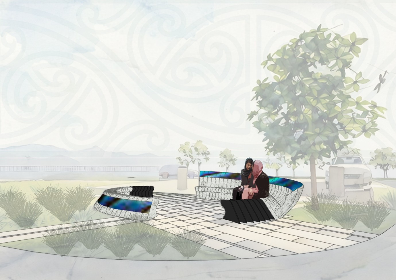
Marking the entrance to the Hutt River Trail this area celebrates the rich culinary traditions of the past, and takes inspiration from the hākari (feasts) held when kai moana (seafood) arrived by waka tēte (canoes).
The design reflects rourou (food baskets), pāua (abalone) - remnants of kai moana left by whānau during hākari celebrations.
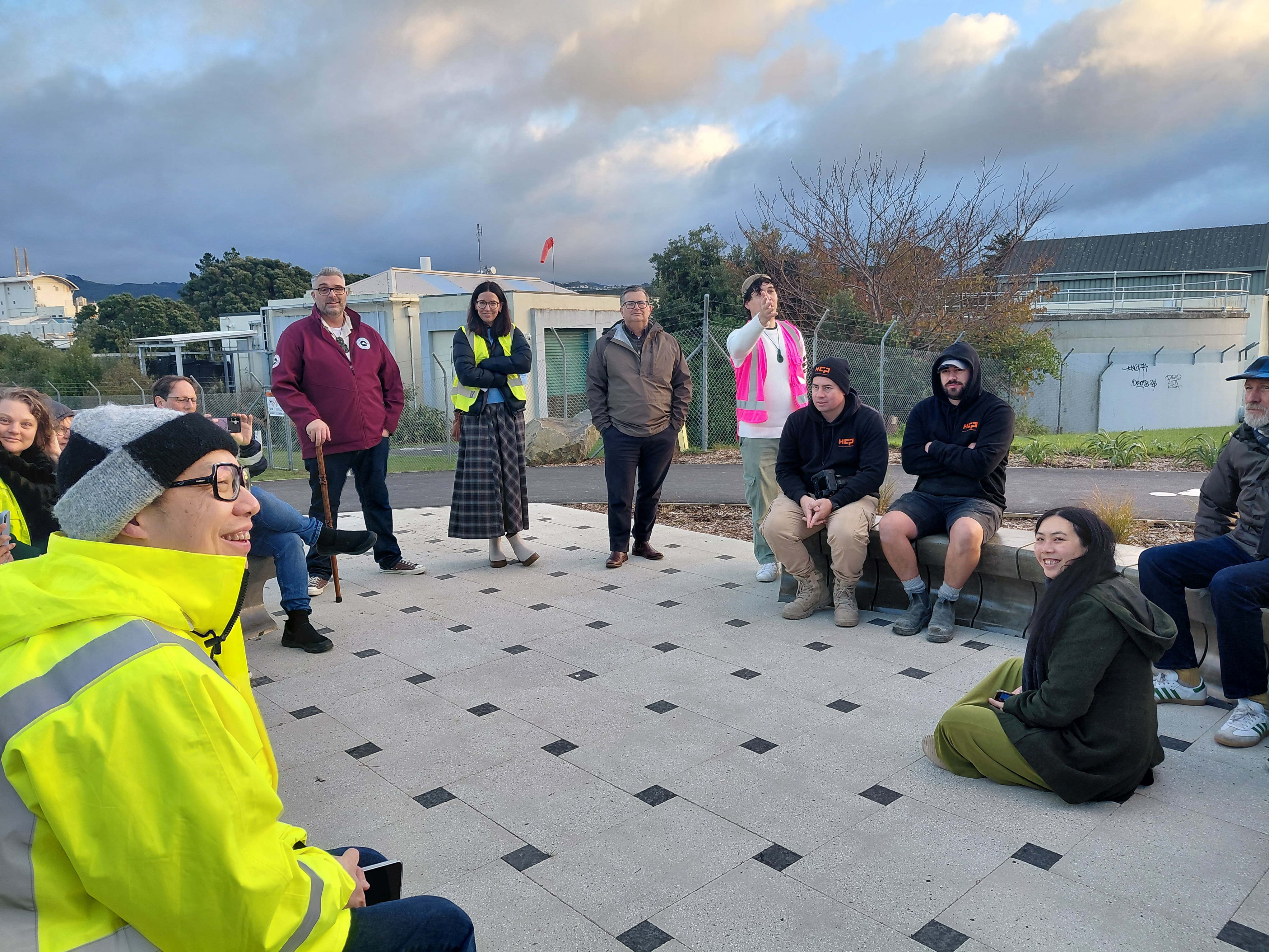
Designed as a place to rest, gather and share kai, people are invited to continue this tradition and to reconnect with the estuary.
Kaitiakitanga - Environmental stewardship
Kaitiakitanga is about environmental stewardship, protecting and enhancing the natural world for future generations. The design reflects this by restoring native ecosystems, reducing waste, and caring for the health of land and water.
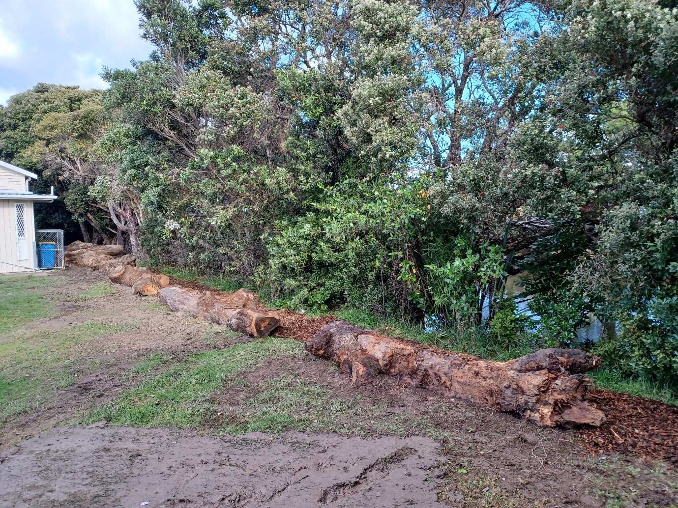
Upcycled logs
Logs reclaimed from the landfill are placed at the Hākari area and at Halford Place to act as a natural barrier to deter dumping and illegal access. This addresses concerns raised by the local community and helps protect the health of the stream.
Old signs, new purpose
Existing Hīkoikoi Reserve signs and posts are being updated and adapted into the new Pā Kahawai marker. This reduces our project’s waste and cost.
Riparian planting
New planting on the banks of Te Mome stream will boost native habitat and support water quality for the estuary.
Get in contact
Got questions about the project? You can contact us at pito_onelandings@huttcity.govt.nz.